
Before borders, the Karoo was a network of meaning
There is growing recognition today of the importance of revisiting these earlier perspectives as a way to deepen our understanding of the Karoo itself.
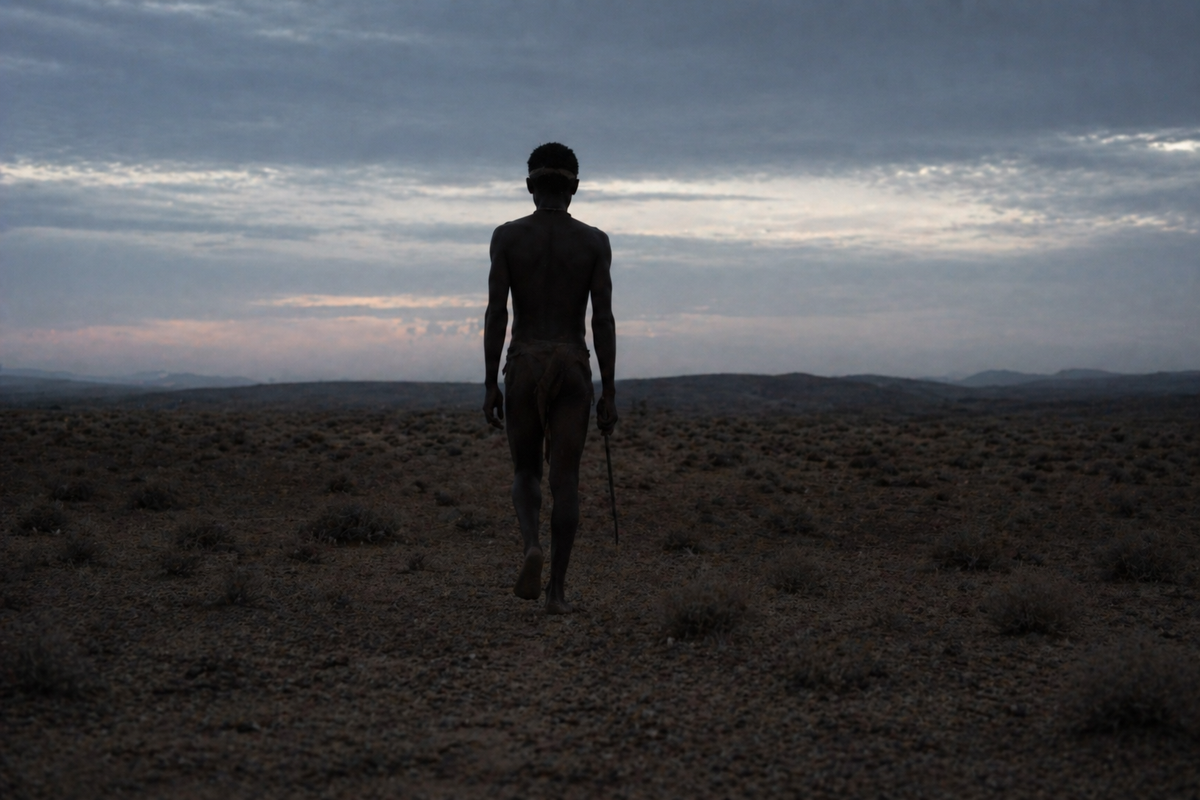
Long before survey lines began to divide the Karoo, the region was already deeply known. For the early inhabitants, particularly the Khoisan peoples, the Karoo was a living system of paths and stories that determined how people travelled the interior and drew sustenance from it.
Colonial mapping later imposed a fixed order, but earlier forms of knowledge were fluid and responsive, grounded in experience and interaction.
Movement as a form of mapping
Knowledge of the land in the indigenous Karoo was gathered through movement. Seasonal migration patterns guided communities between water sources and shelter, while tracking routes became a practical and cultural marker.
These paths followed rainfall, animal behaviour and plant cycles, creating a living map that rerouted with the environment. Water, always scarce in the Karoo, played a central role. Riverbeds and hidden seeps were precisely memorised, passing down through generations the knowledge of when and how they could be accessed.
Instead of fixed borders, there were overlapping zones of use. Territories were understood through relationships that allowed for negotiation and coexistence in a challenging environment.
Stories as spatial knowledge
Oral tradition carried much of this knowledge forward. Stories that encoded geography and ecology offered guidance on where to travel and what to avoid. A particular hill might mark a seasonal turning point, while a cluster of plants could signal water below the surface.
This form of storytelling transformed the Karoo into a narrative landscape. Each feature had the meaning of memory and interpretation. Indigenous knowledge systems functioned as both an archive and guide that preserved essential information. These stories also reinforced a sense of belonging. People were not separate from the land but an essential part of it, responsible for maintaining its balance.
Ecology understood through lived experience
Knowledge of plants and animals was equally sophisticated. Indigenous communities identified edible species, medicinal plants and grazing patterns with remarkable accuracy.
Plants such as spekboom, aloes and various shrubs were valued for their practical uses and their role within the broader ecosystem. Understanding how these species interacted helped guide decisions about movement and resource use so that the land could sustain life over time.
Taking too much from one area could disrupt the system, so that practices were developed that prioritised sustainability, even if they were not described in those terms.
Reclaiming the depth of the Karoo
There is growing recognition today of the importance of revisiting these earlier perspectives as a way to deepen our understanding of the Karoo itself. The region’s history stretches back through generations of lived experience.
Engaging with Khoisan heritage in the Karoo offers a more nuanced view that acknowledges both its physical features and its cultural depth. This is a change from seeing the Karoo as marginal towards recognising it as a place rich with knowledge and memory.
This is important for historical accuracy but also in terms of how the region is approached today. In a time of greater environmental pressure, the principles embedded in these indigenous systems have renewed relevance.
The Karoo, in this sense, is an ongoing story still told by those who understood the land long before it was mapped.

Comments ()